
Table preparation
Before the user can do any type of data fusion, an appropriate field in the attribute table needs to be selected or created. When an analysis needs to be done on an existing field, the user can simply select the field in the Table Mode. When a data fusion for a new value needs to be done, the user will need to create a new field in the attribute table. The following section explains how to create a new field in the table:
|
|
Please note:
|
After highlighting the appropriate layer in the List of Layers, goto the Table mode to display the attribute table of the layer.
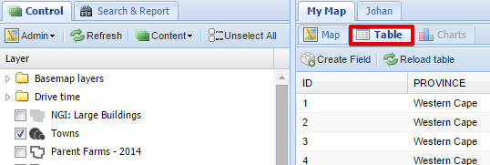
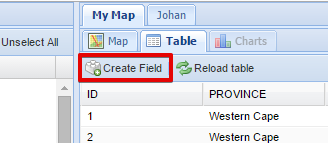
A sub-menu will appear where the user can select the "Create Field" menu item:
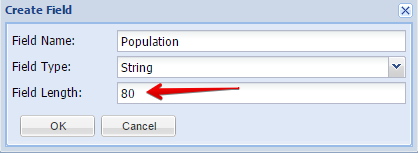
A new dialog box will appear where the user needs to specify the name and type of field to be created. The user can first add the new field name:
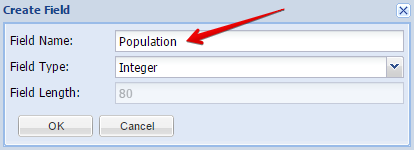
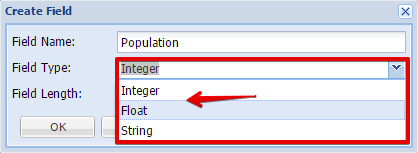
The field type needs to be selected from a dropdown box. There are three types of fields to be created:
-
Integer - a number, for example: 2
-
Float - a number with a . (dot), for example: 2.0 or 0.02
-
String is text, for example both "2" ant "two" are strings, both are just text regardless one of these appearing to be a number for a human who reads it.
-
Integers and floats are for math, strings are for managing text.
The user can now select the appropriate field type
Next the field length needs to be defined. The default value is 80 characters but can be changed if required.
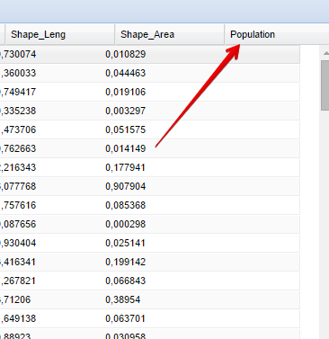
After clicking on the OK button, the new field will be added in the attribute table
The next step is to populate the field with data with either the Field Calculator or the Spatial Analysis Tools.