
Spatial query
Spatial analysis is the process of examining the locations, attributes, and relationships of features in spatial data through overlay and other analytical techniques in order to address a question or gain useful knowledge. Spatial analysis extracts or creates new information from spatial data.
The Spatial Analysis Toolbox is exactly the same as the Spatial Analysis Toolbox for Spatial Report and can be used in the same way. The only difference is that the result will be permanently added to the selected field in the attribute table of the selected layer and added to the spatial database.
|
|
Please note:
|
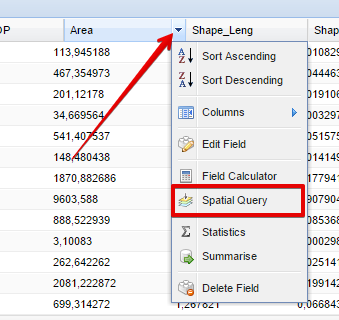
To access the Spatial Analysis Toolbox, the user can click on the field in the attribute table in the Table Mode. Once the user clicked on the dropdown arrow of the field title, the following dropdown box will appear from which the user can select the Spatial Query Toolbox:
After selecting the Spatial Query menu item in the dropdown box, the Spatial Query Toolbox dialog box will appear:
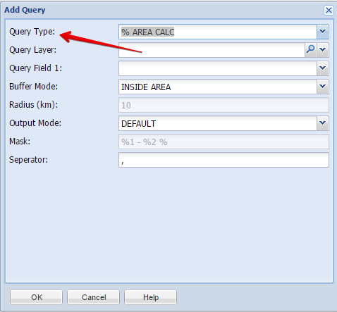
From here, the user can select the type of query based on any other layer in the spatial database to be done. For more information on the different queries, please refer to the Query Toolbox section.