To properly display this page you need a browser with JavaScript support.
×
Menu
Search
To properly display this page you need a browser with JavaScript support.
Search
Search
Main window
Previous page
Next page
Print version
Main window
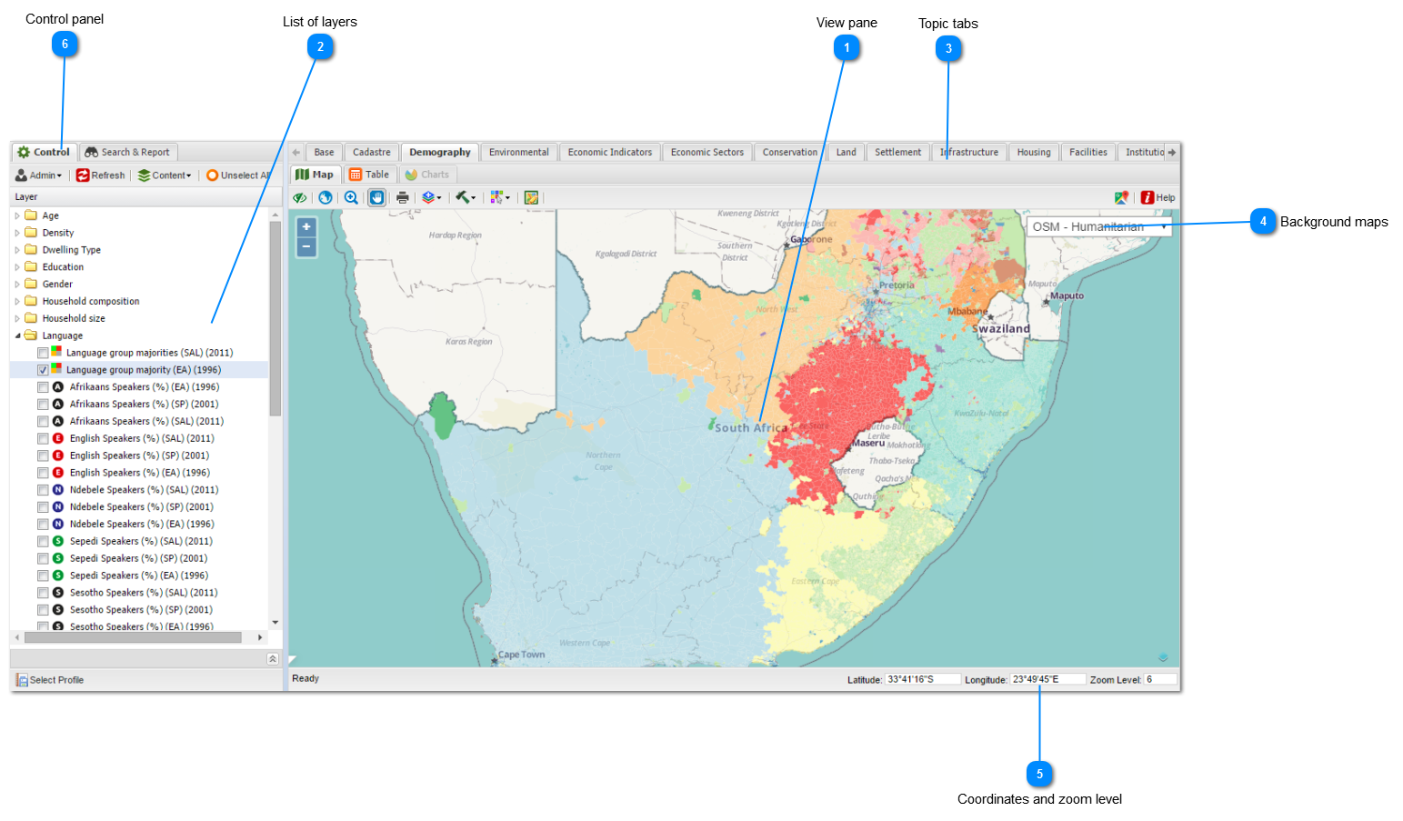
View pane
The view pane is the display area of the maps, tables and charts associated with the layers in your
workspace
. Click
here
for more information.
Top
List of layers
The list of layers shows all the GIS layers opened in the specific
topic tab
. They can be switched on and of using the tick boxes in front of the layer name. Click
here
for more information.
Top
Topic tabs
Topic tabs are designed to help the user group data layers in related topics. Click
here
for more information.
Top
Background maps
The user have a range of background maps to choose from. Click
here
for more information.
Top
Coordinates and zoom level
The coordinates and zoom level are displayed at the bottom right of the screen.
Click
here for more information.
Top
Control panel
Users with administrative rights can customize the maps and various other functions from here. Click here for
more
information
Top
The contents of Main window
View Pane
List of Layers
Topic Tabs
Background Maps
Coordinates and zoom levels
Control panel