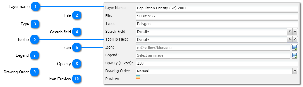
Layer nameThe user can give the specific layer an applicable name and edit it at any later stage.
|
 FileThe file name is an Administrative entry which indicate the layer's ID in the spatial database. The user cannot change it.
|
 TypeThe file type is an Administrative entry which indicate the layer's spatial type in the spatial database. The user cannot change it.
|
 Search field
|
|
Please note: Only use this tool with layers with unique values per entity!!
Not all layers or their attributes is to be regarded as searchable. An example of a good searchable layer is Towns. Each town is represented by a single point entity and once it is selected in the search box, it will zoom to that specific entity. An example of layer that is not regarded as searchable is Geology. There are many polygons in the set with the same attribute. One cannot search and zoom to more that one polygon at once. Thus same layer will be unsuitable and unlogical to be used with this function.
|
|
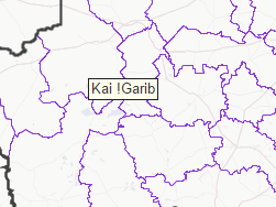
 TooltipThe Tooltip function is a tool which when setup correctly, will show the text of a selected column in the attribute table at the mouse point when the user hover over an area. It typically looks like this:
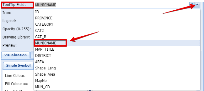
The user can set the Tooltip by selecting the appropriate attribute column in the dropdown list:
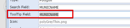
The selected field will now appear in the Tooltip field:
|
 IconThe icon is the image that will appear left of the layer name in the list of layers. The user can add any icon of his/her choice. The only requirement is that it should preferably be at a size 16x16 pixels or smaller to appear correctly in the legend.
MapAble Icon Set
|
|
To assist users, MapAble has a set of icons which can be used by all users. Please go to the MapAble website and download it.
| |
 LegendThe Legend is normally automatically generated for all vector images. In the case of graphics and layers derived from WMS services, a legend file can be uploaded to the server. This will always have to be in PNG graphic format. The suggested size is 270x270 pixels. |
 OpacityThe Opacity for the layer can be set at two places in MapAble. This opacity tool in the Main Layer Input Box can be used to set the global opacity of the layer. Some individual items can be set in the Thematic visualisation toolbox.
The opacity is measured in an index of 0 - 255 of which 0 = none opacity (fully transparent) and 255 = full
|
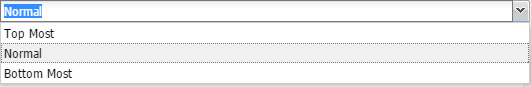
 Drawing OrderThe Drawing Order refers to the way MapAble renders polygons and polylines. The Drawing Order is important in the construction of maps where the user wants certain layers to be displayed above others such as place names above certain polygons. A layer can either be positioned the top or bottom most or normal which means the layer order in the layer list.
|
 Icon PreviewThe Icon Preview shows how the selected Icon will look like in the List of Layers.
|
|